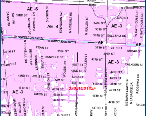
Flood Insurance Rate Maps
Jefferson Parish has had three official flood insurance rates maps. The historic maps are dated July 9, 1976, and March 23, 1995. Jefferson Parish’s current map is dated February 2, 2018. These maps depict the potential for flooding and are the basis for establishing building requirements and flood insurance rates.
To view the maps click the links below:
| Jefferson Parish Geoportal - Flood Maps | Geoportal Instructional Videos | |
 |
 |